开启辅助访问 切换到宽版

北美户外俱乐部

 找回密码
 注册
搜索
热搜: 活动 交友
查看: 8674|回复: 12

2014-05-11 Anif Peak

[复制链接]
扫一扫,手机访问本帖
发表于 2014-5-11 19:15:09 | 显示全部楼层 |阅读模式
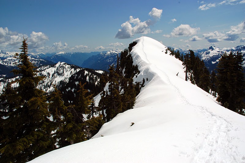
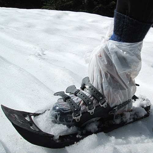
Today went along  forest service road (Mulligan NW spur) to be free from avalanche danger, then short ridge walk on the snow. All was good. Nice views, excellent weather. Snow started from 1,000m, was warm (no wonder, it is mid May already).

Turned out to be a fantastic snowshoe day in Sky Pilot area.  8)

ROUTE STATISTICS
Distance - 17.5 km return
Elevation Gain - 1,337 m
Peak elevation - 1,645 m

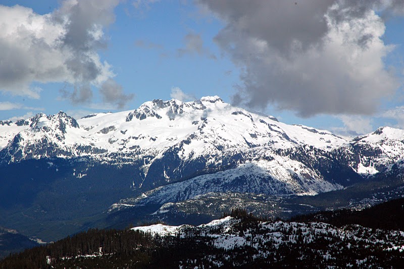
Photo: Mount Niobe (2,021m) seen across Squamish (and Squamish River to the right) from Anif north ridge. Mulligan NW spur bottom right.
 楼主| 发表于 2014-5-12 05:26:47 | 显示全部楼层
Mount Habrich (1,792 m) as seen from the Anif Peak.

"An impressive rock horn located southeast of Squamish, north of the Sky Pilot Group, on the Shannon Creek-Stawamus River divide. " Bivouac.com

 楼主| 发表于 2014-5-12 06:39:09 | 显示全部楼层

Alpine Tip #22 - How to keep feet dry in spring snow

Alpine Tip #22 - How to keep feet dry in spring snow

In spring, the boots are quick to get wet from meting snow. There is no such thing as waterproof boots, given enough time, all boots get wet.

To protect boots from snow, wrap them in plastic bag, so the snow will slide off and not melt on the boot surface. Obviously, gaiters are of little use for this. 8)

发表于 2014-5-12 06:57:42 | 显示全部楼层

Re: Alpine Tip #22 - How to keep feet dry in spring snow

PanShiBo
Alpine Tip #22 - How to keep feet dry in spring snow

In spring, the boots are quick to get wet from meting snow. There is no such thing as waterproof boots, given enough time, all boots get wet.

To protect boots from snow, wrap them in plastic bag, so the snow will slide off and not melt on the boot surface. Obviously, gaiters are of little use for this. 8)


That's a good idea 8)
 楼主| 发表于 2014-5-12 07:47:01 | 显示全部楼层
"Anif Peak is much more spectacular than the tree covered Mulligan. From the summit of Anif, Mulligan is just a tree covered bump. " http://bivouac.com//TripPg.asp?TripId=7814

Photo: Mount Mulligan from North ridge of Anif Peak. Mulligan NW spur on left, further back Squamish River. Atwell peak at skyline.
 楼主| 发表于 2014-5-12 19:40:52 | 显示全部楼层
Anif Peak, North Ridge.

 楼主| 发表于 2014-5-12 21:03:07 | 显示全部楼层
Anif Peak, summit panorama.

 楼主| 发表于 2014-5-13 05:34:08 | 显示全部楼层
Spring avalanches on North Face of Sky Pilot (2,031 m).

 楼主| 发表于 2014-5-13 08:38:44 | 显示全部楼层
Mamquam Mountain (2,588 m), mysterious place.

"Many parties routinely fail to climb this summit" according to Anders Ourom in the Fairley guide.

 楼主| 发表于 2014-5-13 09:46:21 | 显示全部楼层
Mount Sedgwick, 2,082 m

 楼主| 发表于 2014-5-13 11:02:30 | 显示全部楼层
Is it going to grow into a leaf or a flower? Opinions divided. 8)

 楼主| 发表于 2014-5-13 11:36:00 | 显示全部楼层
Atwell Peak (2,655m) in front of Garibaldi mountain (2,675m).  On the left is Brohm Ridge. Black Task is further back.

Photo taken from Anif Peak.

发表于 2015-1-22 11:01:57 | 显示全部楼层
PanShiBo
"Anif Peak is much more spectacular than the tree covered Mulligan. From the summit of Anif, Mulligan is just a tree covered bump. " http://bivouac.com//TripPg.asp?TripId=7814

Photo: Mount Mulligan from North ridge of Anif Peak. Mulligan NW spur on left, further back Squamish River. Atwell peak at skyline.


The name Mt. Mulligan is incorrectly placed on several maps including Bivouac map , Mt. Mulligan  should be moved to the summit 1 km S which is "Anif Peak" that you mentioned :wink:
您需要登录后才可以回帖 登录 | 注册

本版积分规则


小黑屋|Archiver|手机版|北美户外俱乐部

GMT-8, 2024-5-19 15:32 , Processed in 0.066088 second(s), 14 queries , File On.

快速回复 返回顶部 返回列表