开启辅助访问 切换到宽版

北美户外俱乐部

 找回密码
 注册
搜索
热搜: 活动 交友
查看: 14010|回复: 54

2014 JUL 8-10 - Mt. Rainier (4,392 m), WA

[复制链接]
扫一扫,手机访问本帖
发表于 2014-7-10 20:49:45 | 显示全部楼层 |阅读模式
Alpine snow/ice climb: mt. Rainier (4,392 m), WA

Event 5 was completed on 2014 JUL 9

This was an alpine route to the summit of Mt. Rainier via Emmons Glacier from camp Schurman  - unreal day out 8)

发表于 2014-7-10 22:46:26 | 显示全部楼层
:aa10:

This route is more challenging than DC. Congrats!
 楼主| 发表于 2014-7-11 05:09:49 | 显示全部楼层
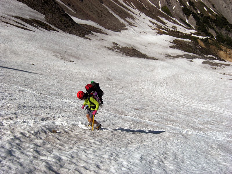
" Mountain climbing on Mount Rainier is difficult, involving traversing the largest glaciers in the U.S. south of Alaska. Most climbers require two to three days to reach the summit. Climbing teams demand experience in glacier travel, self-rescue, and wilderness travel. About 8,000 to 13,000 people attempt the climb each year, about 90% via routes from Camp Muir on the southeast flank. Most of the rest ascend Emmons Glacier via Camp Schurman on the northeast. About half of the attempts are successful, with weather and conditioning being the most common reasons for failure." - wikipedia

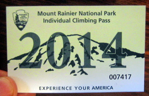
PHOTO: Mount Rainier Climbing Pass
 楼主| 发表于 2014-7-11 05:17:17 | 显示全部楼层
WanchaiBoz
:aa10:

This route is more challenging than DC. Congrats!


多謝! 8)
 楼主| 发表于 2014-7-11 06:06:37 | 显示全部楼层
TRIP STATISTICS
Leg 3 : Camp Schurman  - Summit of Mt. Rainier
Start Elevation @ Camp Schurman - 2,899 m
Summit - 4,392 m
Elevation Gain: 1,493 m
Time : climb 5h50m, return 3h35m

PHOTO: it is big! Mount Rainier (4,392 m) is only few meters shorter than tallest mountain in contiguous United States  ( Mount Whitney 4,421 m)

 楼主| 发表于 2014-7-11 06:44:54 | 显示全部楼层
Conditions are looking good, keep fingers crossed!

PHOTO: current weather forecast at White River ranger station, Mount Rainier, WA

 楼主| 发表于 2014-7-11 17:59:24 | 显示全部楼层
All climbers who plan to climb above high camps, Camp Muir and Camp Schurman, are required by law to purchase a Mount Rainier Climbing Pass and register for their climb.

- wikipedia

 楼主| 发表于 2014-7-11 18:22:30 | 显示全部楼层
PHOTO: White River Ranger Station, Mt Rainier, WA

 楼主| 发表于 2014-7-11 19:18:06 | 显示全部楼层
White River Parking Lot, Mt Rainier, WA
 楼主| 发表于 2014-7-12 05:20:54 | 显示全部楼层
Nice approach trail. The pack is regular weight, 40 lb that is, includes camping and climbing equipment.

PHOTO: Glacier Basin Trail, Mt Rainier, WA
 楼主| 发表于 2014-7-12 07:55:57 | 显示全部楼层
Alpine meadows just next to the tourist campground at the end of Glacier basin Trail. Tip of Mt Rainier visible at the upper left corner.

PHOTO:Glacier Basin, Mt Rainier, WA
 楼主| 发表于 2014-7-12 10:41:26 | 显示全部楼层
PHOTO: Approaching Inter Glacier, Mt Rainier, WA
 楼主| 发表于 2014-7-12 12:06:24 | 显示全部楼层
A large group, most likely commercial, is entering Inter Glacier. Tip of Mt Rainier visible at the right upper corner.

 楼主| 发表于 2014-7-12 15:46:58 | 显示全部楼层
在这么高 (2400米),心跳快是很平常的

 楼主| 发表于 2014-7-12 17:39:59 | 显示全部楼层
Mt Rainier is so tall, that even base camps are located higher than most of the mountain tops of BC. Camp Curtis sits at 2,760 m above sea level - higher than Mt Garibaldi, BC (2,675 m)

 楼主| 发表于 2014-7-12 17:43:28 | 显示全部楼层
晚霞的时候

PHOTO: looking north from camp Curtis, Mt Rainier NP, WA
 楼主| 发表于 2014-7-12 18:00:42 | 显示全部楼层
Curtis营地 - 第二天的日出
 楼主| 发表于 2014-7-12 18:06:43 | 显示全部楼层
05:52 a.m., views from camp Curtis

 楼主| 发表于 2014-7-12 18:10:18 | 显示全部楼层
 楼主| 发表于 2014-7-12 18:57:32 | 显示全部楼层
Leaving camp Curtis.

您需要登录后才可以回帖 登录 | 注册

本版积分规则


小黑屋|Archiver|手机版|北美户外俱乐部

GMT-8, 2024-5-7 01:59 , Processed in 0.130282 second(s), 5 queries , File On.

快速回复 返回顶部 返回列表